
12 days tour - special for Patrizio
The tour description has not been added yet.
Dates and pricing
Rider LLC · Applications closed
24.08.2026 — 03.09.2026
Day-by-day route
Day 1BishkekArrival day · City Stay
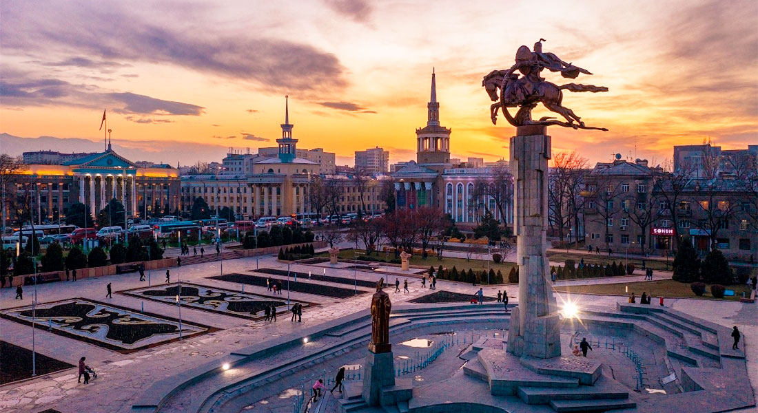
Bishkek (Kyrgyz: Бишкек, IPA: [biʃˈkek]; Russian: Бишкек), formerly Pishpek and Frunze, is the capital and largest city of Kyrgyzstan. Bishkek is also the administrative centre of the Chüy Region. The region surrounds the city, although the city itself is not part of the region but rather a region-level unit of Kyrgyzstan. Bishkek is situated near the Kazakhstan–Kyrgyzstan border with its population being 1,074,075 in 2021.
Overnight: City Stay
Day 2Bishkek → Kyzyl-Oi200 km
Bishkek (Kyrgyz: Бишкек, IPA: [biʃˈkek]; Russian: Бишкек), formerly Pishpek and Frunze, is the capital and largest city of Kyrgyzstan. Bishkek is also the administrative centre of the Chüy Region. The region surrounds the city, although the city itself is not part of the region but rather a region-level unit of Kyrgyzstan. Bishkek is situated near the Kazakhstan–Kyrgyzstan border with its population being 1,074,075 in 2021.
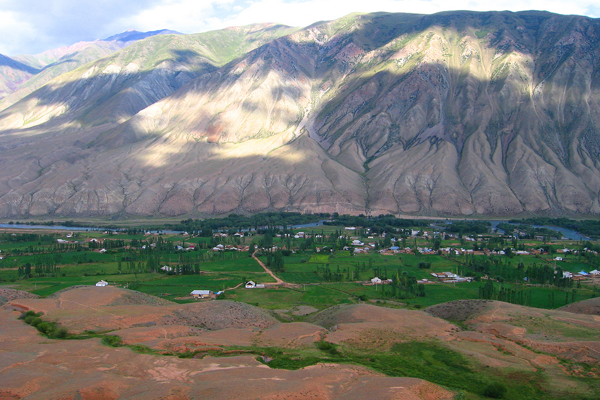
Kyzyl-Oi (Kyzyl-Oy) is a mountain village located at an altitude of about 1800 m above sea level, in the valley of the mighty Kokomeren River. Here your eyes will see the extraordinary landscape of the majestic mountains surrounding Kyzyl-Oy on all sides.
Overnight: Not specified
Day 3Kyzyl-Oi → Son Kyl150 km
Kyzyl-Oi (Kyzyl-Oy) is a mountain village located at an altitude of about 1800 m above sea level, in the valley of the mighty Kokomeren River. Here your eyes will see the extraordinary landscape of the majestic mountains surrounding Kyzyl-Oy on all sides.
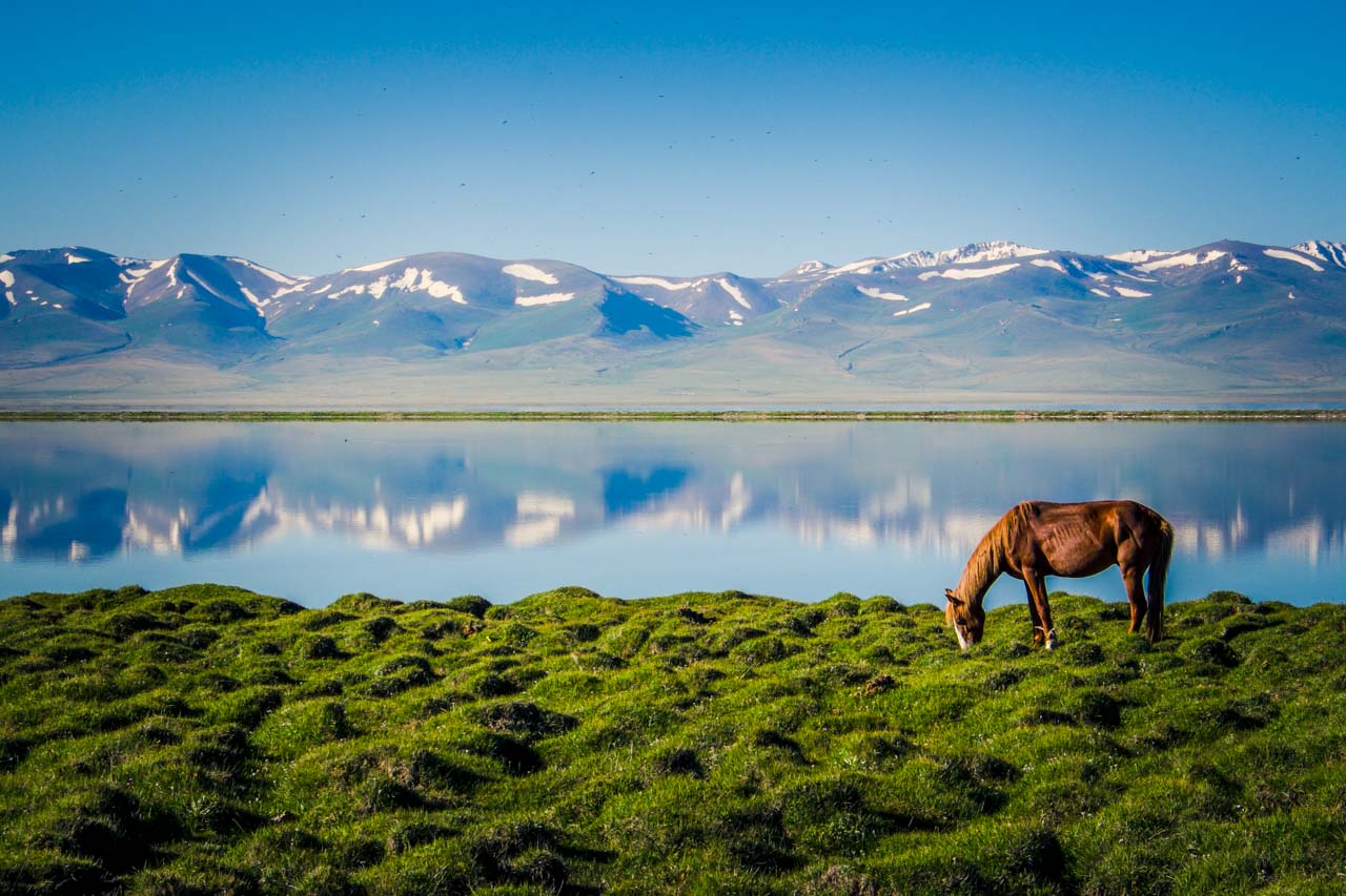
Sonkel is a large alpine lake, sandwiched in a basin between the internal spurs of the Tien Shan. Located between the Sonkel-Too and Moldo-Too ridges, at an altitude of 3016 m above sea level in the northwestern part of the Naryn region.
Overnight: Not specified
Day 4Son Kyl → Naryn300 km
Sonkel is a large alpine lake, sandwiched in a basin between the internal spurs of the Tien Shan. Located between the Sonkel-Too and Moldo-Too ridges, at an altitude of 3016 m above sea level in the northwestern part of the Naryn region.
Overnight: Not specified
Day 5Naryn → Arabel Pass → Aksai Canyon330 km · Tent outdoors
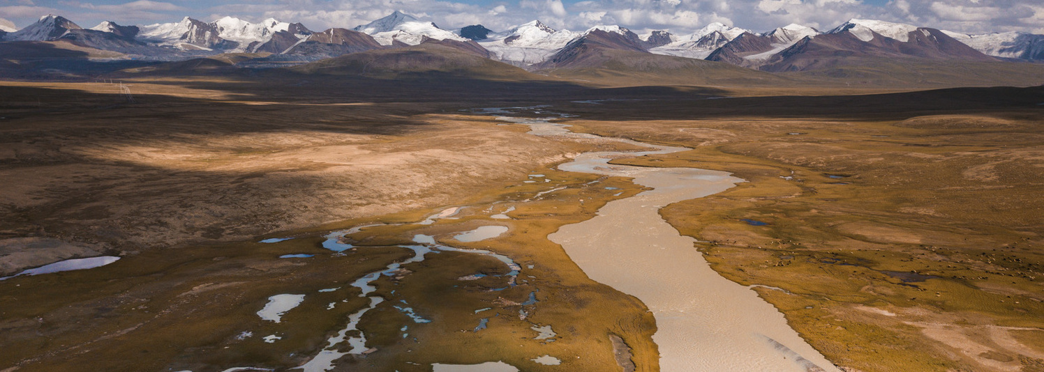
The Arabel Plateau (Arabel-Suu Valley) is a stunning and harsh alpine valley located in the southern part of Kyrgyzstan's Issyk-Kul Region, just south of the Terskey Alatoo Range. Extreme altitude: The plateau sits at an elevation of about 3,800 to 4,000 meters above sea level. Due to these conditions, it is referred to as a "syrt"—a high-altitude tableland rare for Central Asia, where the mountains do not seem that high because the valley floor itself is already lifted nearly to the clouds.
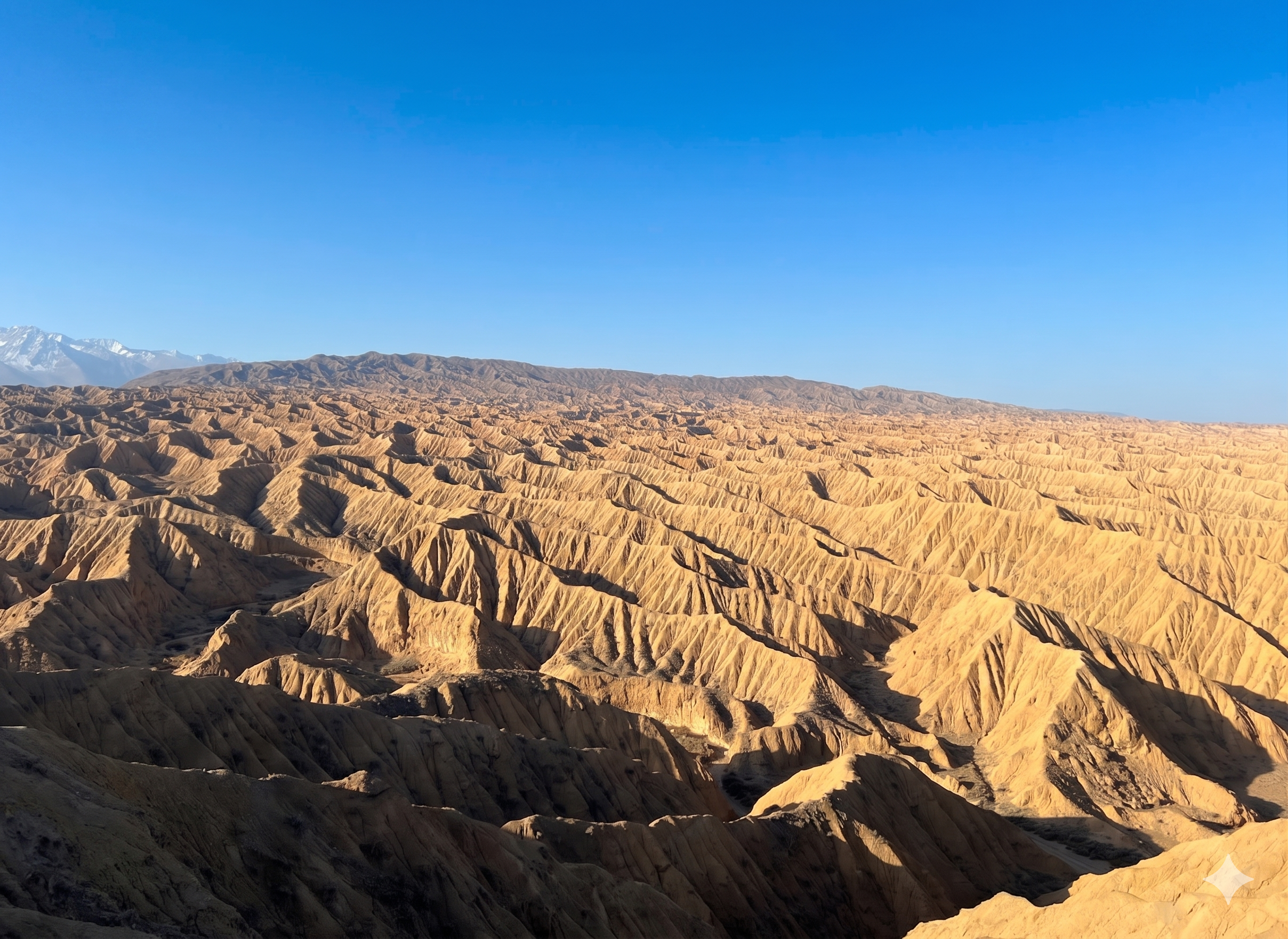
The Aksai Canyons (or Aksai Canyons) are a stunning, yet still relatively little-known location on the southern shore of Lake Issyk-Kul. It is located approximately 16-20 km west of the town of Bokonbaevo, near the eponymous village of Aksai.Due to its geological structure and proximity to the famous Skazka Canyon, Aksai is often compared to it. However, the landscape here is more monochrome; warm ochre, golden, and sandy hues dominate, and the scale of the maze of hills appears even more monumental and wild.
Overnight: Tent outdoors
Day 6Aksai Canyon0 km · Tent outdoors
The Aksai Canyons (or Aksai Canyons) are a stunning, yet still relatively little-known location on the southern shore of Lake Issyk-Kul. It is located approximately 16-20 km west of the town of Bokonbaevo, near the eponymous village of Aksai.Due to its geological structure and proximity to the famous Skazka Canyon, Aksai is often compared to it. However, the landscape here is more monochrome; warm ochre, golden, and sandy hues dominate, and the scale of the maze of hills appears even more monumental and wild.
Overnight: Tent outdoors
Day 7Aksai Canyon → Karakol235 km · Tent outdoors
The Aksai Canyons (or Aksai Canyons) are a stunning, yet still relatively little-known location on the southern shore of Lake Issyk-Kul. It is located approximately 16-20 km west of the town of Bokonbaevo, near the eponymous village of Aksai.Due to its geological structure and proximity to the famous Skazka Canyon, Aksai is often compared to it. However, the landscape here is more monochrome; warm ochre, golden, and sandy hues dominate, and the scale of the maze of hills appears even more monumental and wild.
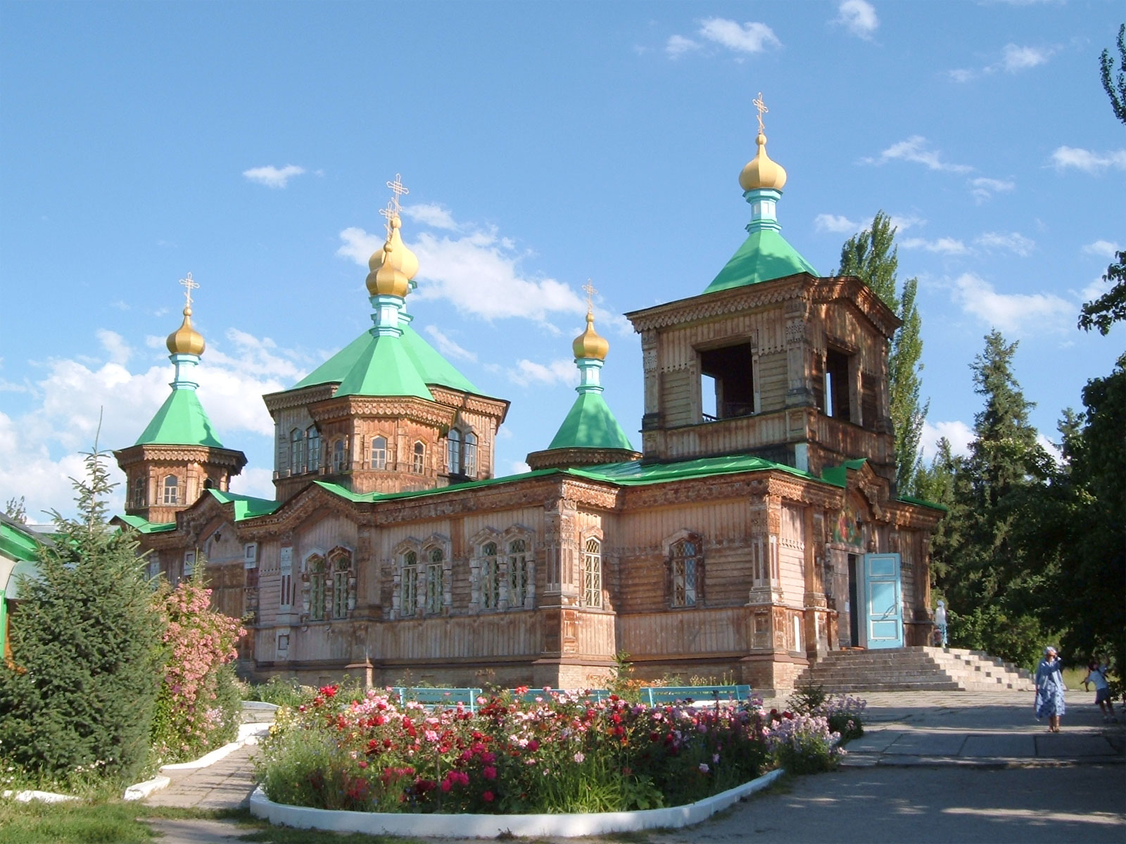
Karakol (Kyrgyz: Каракол, romanized: Karakol, قاراقول, Kyrgyz pronunciation: [qɑrɑqoɫ]), formerly Przhevalsk (Russian: Пржевальск), is the fourth-largest city in Kyrgyzstan, near the eastern tip of Lake Issyk-Kul, about 150 kilometres (93 mi) from the Kyrgyzstan–China border and 380 kilometres (240 mi) from the capital Bishkek. It is the administrative capital of Issyk-Kul Region.
Overnight: Tent outdoors
Day 8Karakol → Sary Jaz → Jyrgalan245 km · Tent outdoors
Karakol (Kyrgyz: Каракол, romanized: Karakol, قاراقول, Kyrgyz pronunciation: [qɑrɑqoɫ]), formerly Przhevalsk (Russian: Пржевальск), is the fourth-largest city in Kyrgyzstan, near the eastern tip of Lake Issyk-Kul, about 150 kilometres (93 mi) from the Kyrgyzstan–China border and 380 kilometres (240 mi) from the capital Bishkek. It is the administrative capital of Issyk-Kul Region.
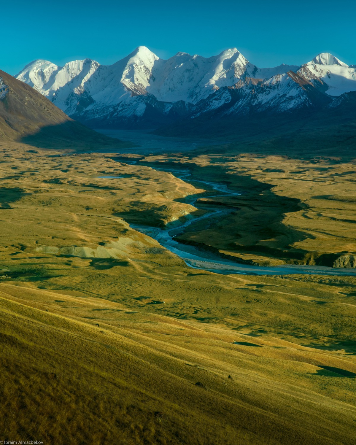
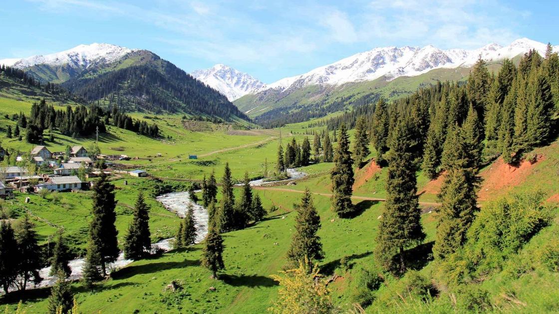
Sary-Jaz (Sarydzhaz) is one of the wildest, most remote, and yet stunningly beautiful regions of Kyrgyzstan. It is located in the eastern part of the Issyk-Kul Region, right at the foot of the highest peaks of the Central Tien Shan (Khan Tengri and Pobeda peaks), directly on the border with China.In this region, the name "Sary-Jaz" (which translates as "yellow spring" or "yellow nomad camp") belongs to several geographical features at once: a powerful river, a vast high-altitude valley, a mountain range, and a unique vanishing lake.
Overnight: Tent outdoors
Day 9Jyrgalan → Cholpon-Ata235 km · Tent outdoors
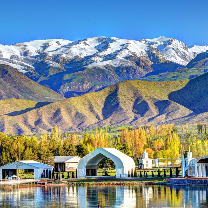
Cholpon-Ata (Kyrgyz: Чолпон-Ата, Çolpon-Ata, چولپون-اتا, pronounced [tʃolponɑtɑ́], literally "Venus-father", the name of a mythological protecting spirit) is a resort town on the northern shore of Lake Issyk-Kul in Kyrgyzstan with a population of 14,237 (2021). It is the administrative center of the Issyk-Kul District of the Issyk-Kul Region; this district occupies most of the lake's north shore.
Overnight: Tent outdoors
Day 10Cholpon-Ata → Chon-Kemin160 km · Tent outdoors
Cholpon-Ata (Kyrgyz: Чолпон-Ата, Çolpon-Ata, چولپون-اتا, pronounced [tʃolponɑtɑ́], literally "Venus-father", the name of a mythological protecting spirit) is a resort town on the northern shore of Lake Issyk-Kul in Kyrgyzstan with a population of 14,237 (2021). It is the administrative center of the Issyk-Kul District of the Issyk-Kul Region; this district occupies most of the lake's north shore.
Overnight: Tent outdoors
Day 11Chon-Kemin → Bishkek150 km
Bishkek (Kyrgyz: Бишкек, IPA: [biʃˈkek]; Russian: Бишкек), formerly Pishpek and Frunze, is the capital and largest city of Kyrgyzstan. Bishkek is also the administrative centre of the Chüy Region. The region surrounds the city, although the city itself is not part of the region but rather a region-level unit of Kyrgyzstan. Bishkek is situated near the Kazakhstan–Kyrgyzstan border with its population being 1,074,075 in 2021.
Overnight: Not specified
Loading route tracks…
Explore the full route ↗Route photographs
Photographs of locations on this route.