
10 days Nomad’s Way
The tour description has not been added yet.
Dates and pricing
No tour dates are open for booking right now. Contact us to arrange your own dates.
Day-by-day route
Day 1BishkekArrival day
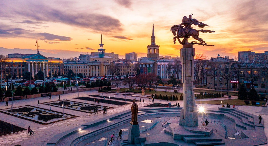
Bishkek (Kyrgyz: Бишкек, IPA: [biʃˈkek]; Russian: Бишкек), formerly Pishpek and Frunze, is the capital and largest city of Kyrgyzstan. Bishkek is also the administrative centre of the Chüy Region. The region surrounds the city, although the city itself is not part of the region but rather a region-level unit of Kyrgyzstan. Bishkek is situated near the Kazakhstan–Kyrgyzstan border with its population being 1,074,075 in 2021.
Overnight: Not specified
Day 2Bishkek → Kyzyl-Oi200 km
Bishkek (Kyrgyz: Бишкек, IPA: [biʃˈkek]; Russian: Бишкек), formerly Pishpek and Frunze, is the capital and largest city of Kyrgyzstan. Bishkek is also the administrative centre of the Chüy Region. The region surrounds the city, although the city itself is not part of the region but rather a region-level unit of Kyrgyzstan. Bishkek is situated near the Kazakhstan–Kyrgyzstan border with its population being 1,074,075 in 2021.
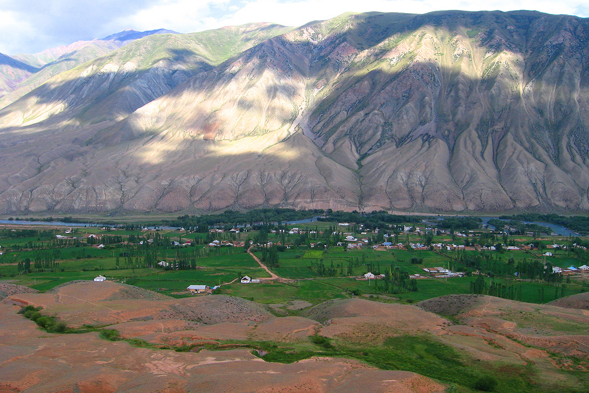
Kyzyl-Oi (Kyzyl-Oy) is a mountain village located at an altitude of about 1800 m above sea level, in the valley of the mighty Kokomeren River. Here your eyes will see the extraordinary landscape of the majestic mountains surrounding Kyzyl-Oy on all sides.
Overnight: Not specified
Day 3Kyzyl-Oi → Son Kyl150 km
Kyzyl-Oi (Kyzyl-Oy) is a mountain village located at an altitude of about 1800 m above sea level, in the valley of the mighty Kokomeren River. Here your eyes will see the extraordinary landscape of the majestic mountains surrounding Kyzyl-Oy on all sides.
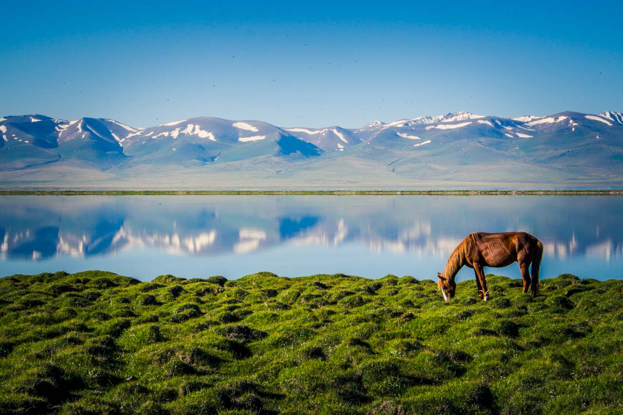
Sonkel is a large alpine lake, sandwiched in a basin between the internal spurs of the Tien Shan. Located between the Sonkel-Too and Moldo-Too ridges, at an altitude of 3016 m above sea level in the northwestern part of the Naryn region.
Overnight: Not specified
Day 4Son Kyl → Tash Rabat185 km
Sonkel is a large alpine lake, sandwiched in a basin between the internal spurs of the Tien Shan. Located between the Sonkel-Too and Moldo-Too ridges, at an altitude of 3016 m above sea level in the northwestern part of the Naryn region.
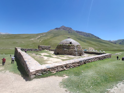
Surrounded by mountains, the 15th-century stone caravanserai has 31 rooms with vaulted ceilings.
Overnight: Not specified
Day 5Tash Rabat → Eki Naryn240 km · Tent's accommodation
Surrounded by mountains, the 15th-century stone caravanserai has 31 rooms with vaulted ceilings.
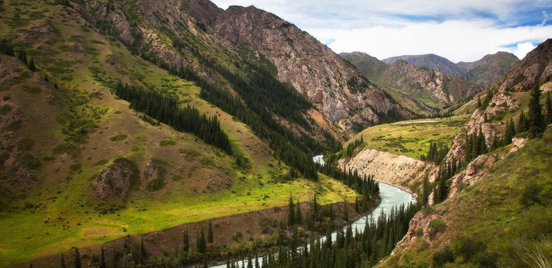
The Eki-Naryn Valley is home to a small village of the same name, located about 40 km (25 miles) from Naryn. The valley is nested in high mountains and is the perfect place to discover the breath-taking landscapes of the region.
Overnight: Tent's accommodation
Day 6Eki Naryn → Bokonbayevo270 km
The Eki-Naryn Valley is home to a small village of the same name, located about 40 km (25 miles) from Naryn. The valley is nested in high mountains and is the perfect place to discover the breath-taking landscapes of the region.
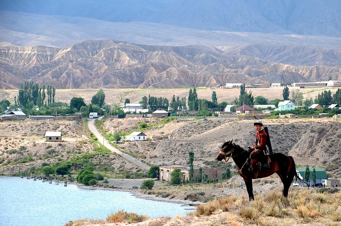
Bokonbayevo is a small town of 12,500 inhabitants located on the south shore of Issyk-Kul Lake, 160 km (99.4 miles) West of Karakol and 280 km (174 miles) East of Bishkek. The village got its name from a Kyrgyz poet.
Overnight: Not specified
Day 7Bokonbayevo → Karakol210 km
Bokonbayevo is a small town of 12,500 inhabitants located on the south shore of Issyk-Kul Lake, 160 km (99.4 miles) West of Karakol and 280 km (174 miles) East of Bishkek. The village got its name from a Kyrgyz poet.
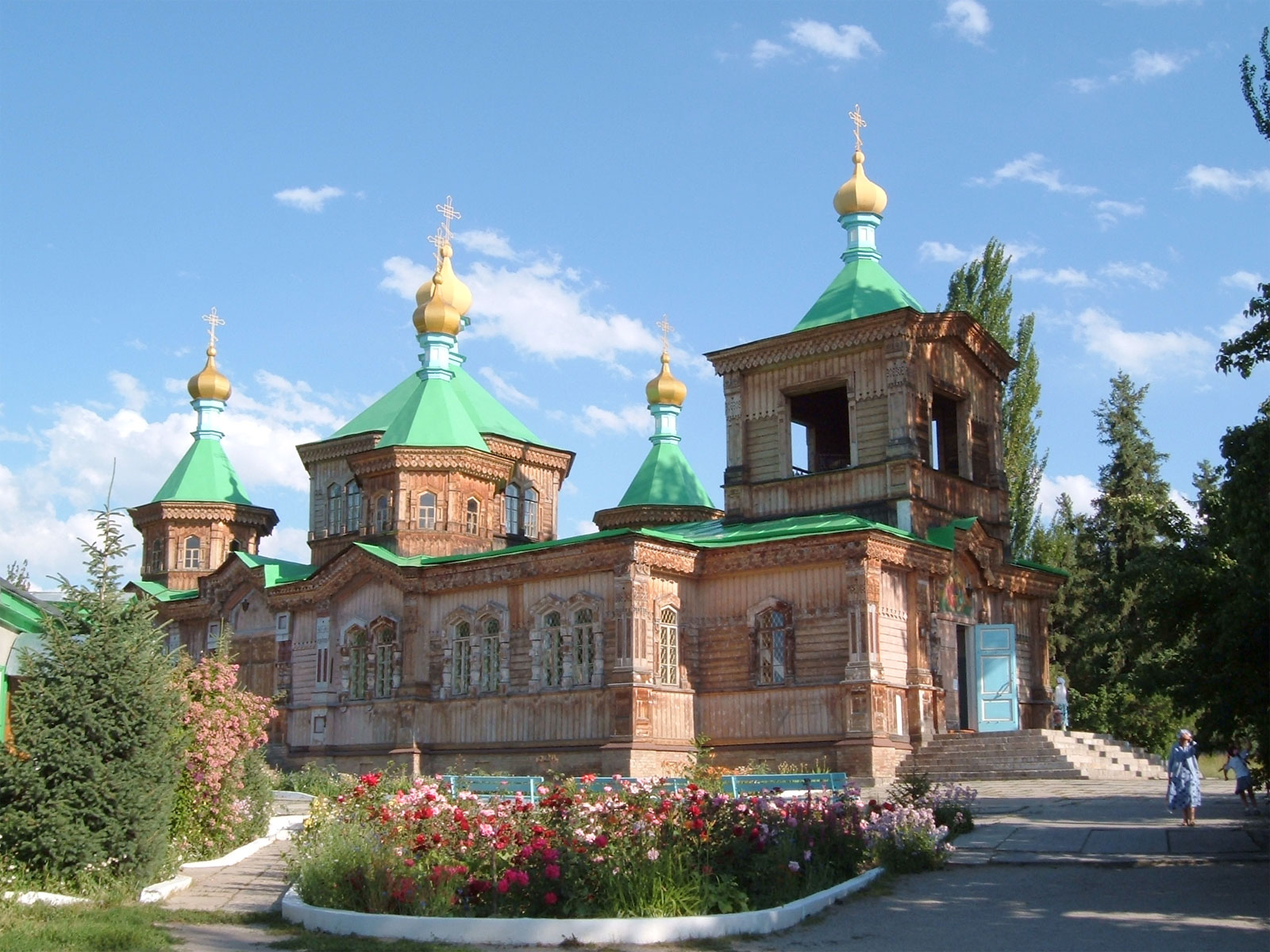
Karakol (Kyrgyz: Каракол, romanized: Karakol, قاراقول, Kyrgyz pronunciation: [qɑrɑqoɫ]), formerly Przhevalsk (Russian: Пржевальск), is the fourth-largest city in Kyrgyzstan, near the eastern tip of Lake Issyk-Kul, about 150 kilometres (93 mi) from the Kyrgyzstan–China border and 380 kilometres (240 mi) from the capital Bishkek. It is the administrative capital of Issyk-Kul Region.
Overnight: Not specified
Day 8Karakol → Cholpon-Ata180 km
Karakol (Kyrgyz: Каракол, romanized: Karakol, قاراقول, Kyrgyz pronunciation: [qɑrɑqoɫ]), formerly Przhevalsk (Russian: Пржевальск), is the fourth-largest city in Kyrgyzstan, near the eastern tip of Lake Issyk-Kul, about 150 kilometres (93 mi) from the Kyrgyzstan–China border and 380 kilometres (240 mi) from the capital Bishkek. It is the administrative capital of Issyk-Kul Region.
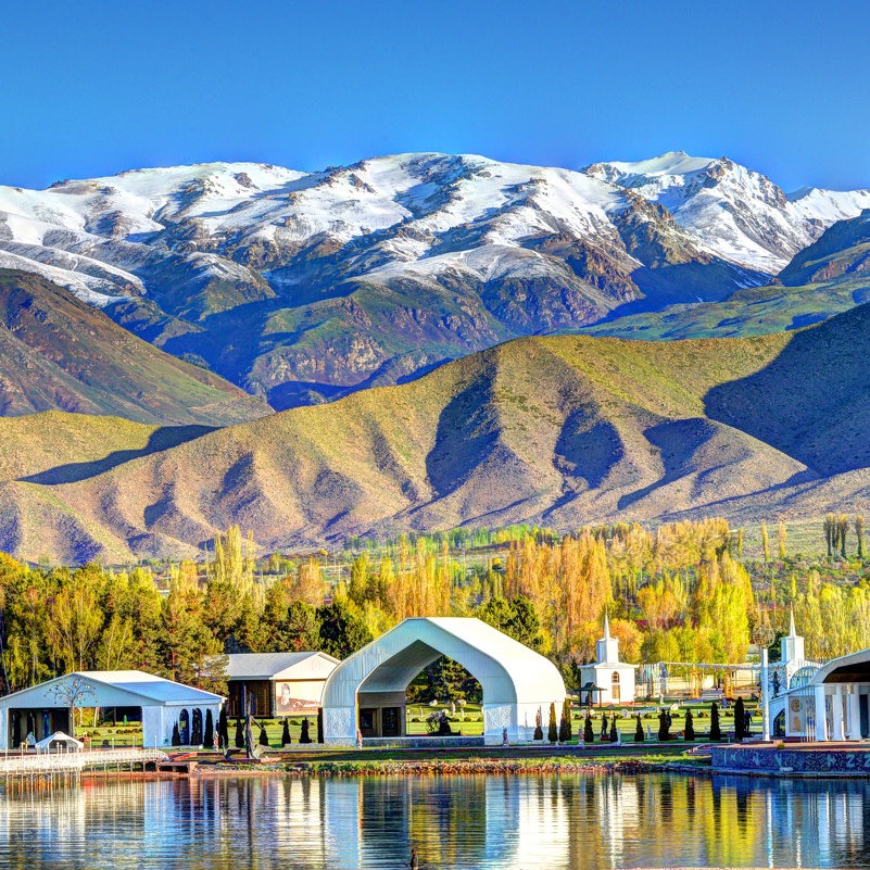
Cholpon-Ata (Kyrgyz: Чолпон-Ата, Çolpon-Ata, چولپون-اتا, pronounced [tʃolponɑtɑ́], literally "Venus-father", the name of a mythological protecting spirit) is a resort town on the northern shore of Lake Issyk-Kul in Kyrgyzstan with a population of 14,237 (2021). It is the administrative center of the Issyk-Kul District of the Issyk-Kul Region; this district occupies most of the lake's north shore.
Overnight: Not specified
Day 9Cholpon-Ata → Bishkek250 km
Cholpon-Ata (Kyrgyz: Чолпон-Ата, Çolpon-Ata, چولپون-اتا, pronounced [tʃolponɑtɑ́], literally "Venus-father", the name of a mythological protecting spirit) is a resort town on the northern shore of Lake Issyk-Kul in Kyrgyzstan with a population of 14,237 (2021). It is the administrative center of the Issyk-Kul District of the Issyk-Kul Region; this district occupies most of the lake's north shore.
Bishkek (Kyrgyz: Бишкек, IPA: [biʃˈkek]; Russian: Бишкек), formerly Pishpek and Frunze, is the capital and largest city of Kyrgyzstan. Bishkek is also the administrative centre of the Chüy Region. The region surrounds the city, although the city itself is not part of the region but rather a region-level unit of Kyrgyzstan. Bishkek is situated near the Kazakhstan–Kyrgyzstan border with its population being 1,074,075 in 2021.
Overnight: Not specified
Loading route tracks…
Explore the full route ↗Route photographs
Photographs of locations on this route.